3D bounding boxes, object segmentation, and ground-truth labeling for point-cloud perception.
Anonymized samples from our LiDAR work: 3D boxes and segmentation on real scenes.
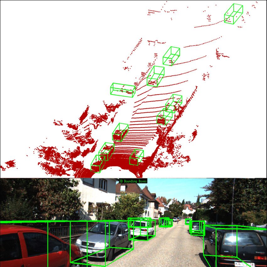
3D bounding boxes & segmentation
Object-level 3D ground truth
Object-level boxes with orientation for vehicles, pedestrians, and infrastructure.
Point-level classification of roads, vegetation, buildings, and objects.
LiDAR-to-camera alignment and joint labeling for fusion stacks.
Send a sample, and we'll return labeled examples and a fixed-scope quote.
Request a Sample Batch3D bounding boxes (cuboids), semantic segmentation, object tracking, and ground-truth labeling across LiDAR scenes.
Yes. We scale from pilot batches to full production datasets with multi-tier QA and batch-level traceability.
Point-cloud annotation: 3D boxes and segmentation on real LiDAR scenes.
Yes. Anonymized point-cloud samples from production LiDAR work.
Send a sample; XYNTRIQ returns labeled examples and a fixed-scope quote.
 XYNTRIQ